
Waterfalls are a great destination year-round because they are always changing. Spring runoff brings high flow. Hot August days reduce the waterfall’s flow revealing underlying rocks. Freezing temperatures exhibit awesome ice formations.
Myrtle Creek Falls, Snow Creek Falls, Copper Falls and Kootenai Falls are four easy, family-friendly waterfall hikes within an hour of Bonners Ferry that are accessible three or four seasons a year, depending on road and trail conditions.
1) Myrtle Creek Falls
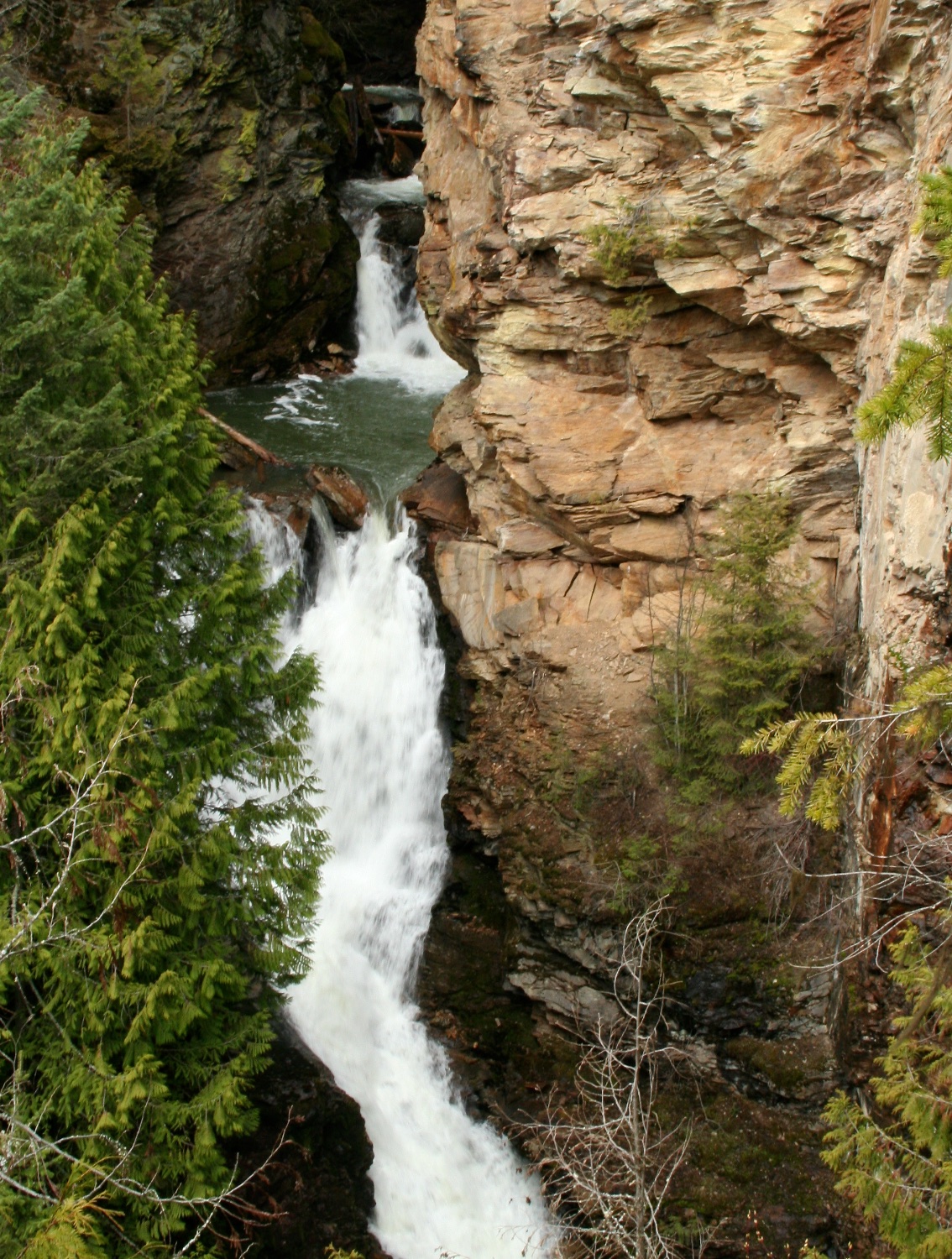
A quick, year-round hike leads to tiered Myrtle Creek Falls which has two drops totally 100 feet.
The 0.5-mile trail is paved to the bridge crossing Myrtle Creek making it handicap accessible to there. Then the dirt trail is well-maintained to the fenced overlook.
The trail is family-friendly (though it can be icy in the winter) but no dogs are allowed on the trail.
The trailhead is located across from the Kootenai National Wildlife Refuge office and restrooms on the Westside Road 6 miles west of Bonners Ferry.
If you have time, follow the hike with a drive (walk, bike or ski) on the 4.5-mile Auto Tour which starts next to the Refuge Office. The Refuge is home to deer, moose, coyotes, bear, ducks and numerous other animals.
2) Snow Creek Falls
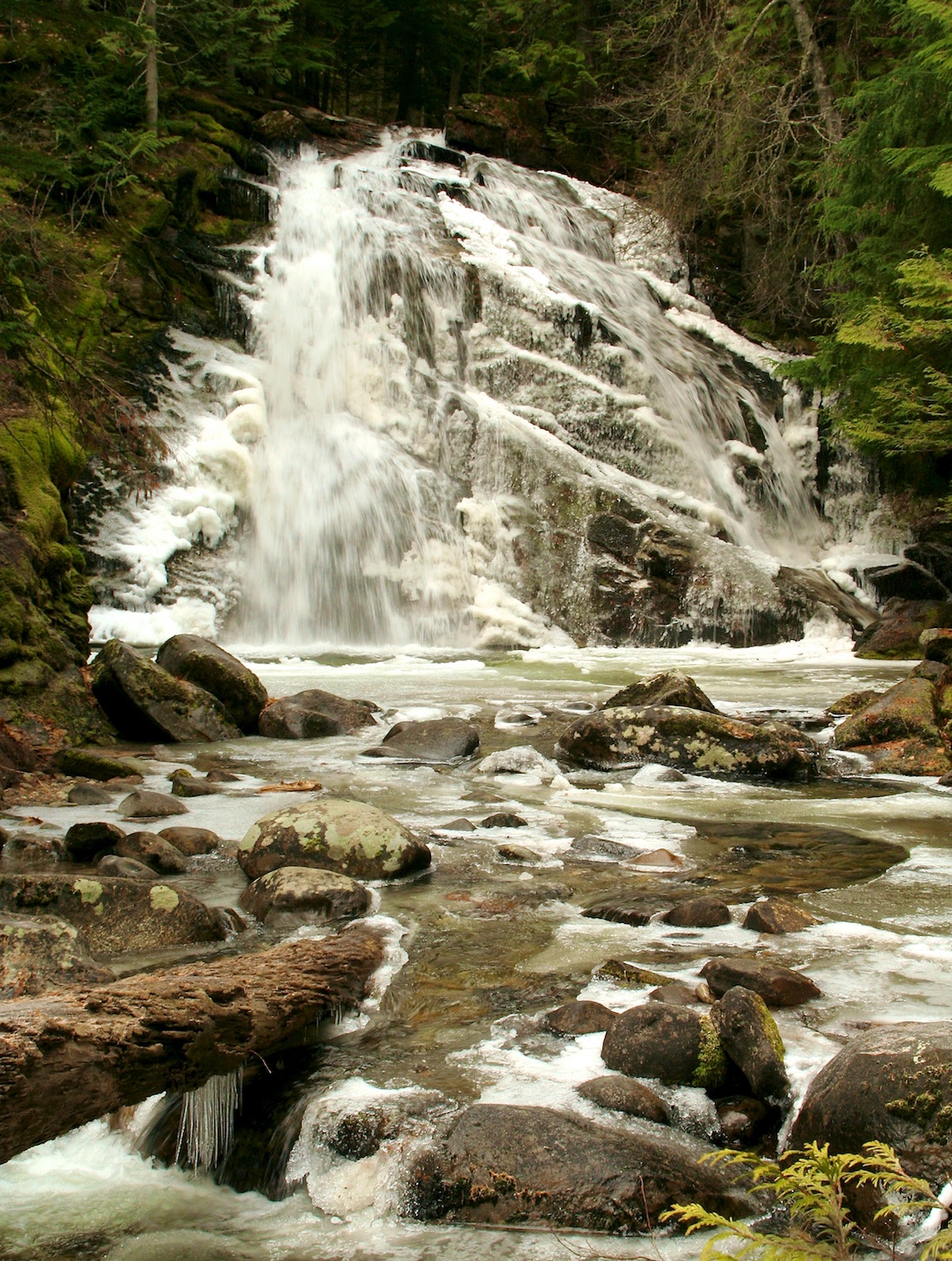
An Upper Falls and Lower Falls offer two different types of waterfalls at Snow Creek Falls. The Upper Falls is a bridal veil waterfall with a 30 foot drop. The Lower Falls consists of multiple cascades with a 20 foot drop.
The 1.7-mile hike is family and dog-friendly. At the first trail junction, the lower trail leads to the Lower Falls and the upper trail leads to the Upper Falls. You’ll have to backtrack to the junction to visit both falls. Both trails have an observation deck near the falls.
The upper trail winds through some impressive old growth forest while the beginning of the trail showcases dry ponderosa hillside. A huge Ponderosa Pine grows near the trail junction.
The trailhead turnout is 1.2 miles up Road 402 (Snow Creek Road) off of Lions Den Road about 9 miles southwest of Bonners Ferry.
3) Copper Falls
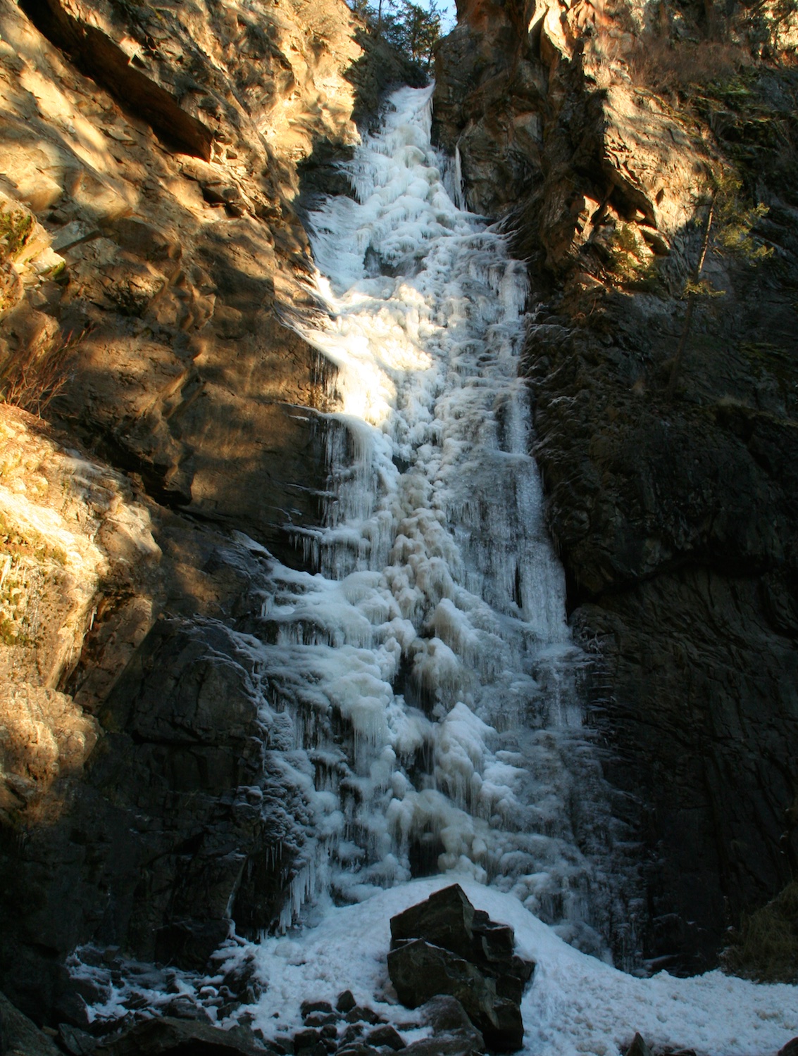
The 225-foot narrow plunge over a rocky ledge can be viewed from a close, feel-the-mist overlook. The Copper Falls trail is a 1.4-mile loop that is a family and dog-friendly with about 150’ elevation gain.
The trail is a self-guided nature hike with interpretive signs along the trail describing different plants and animals found in the surrounding habitat.
If road conditions permit, Copper Falls has spectacular ice formations in winter.
To reach the Copper Falls trailhead, follow US Hwy 95 north of Bonners Ferry for 33 miles (almost to the Canadian border). After crossing the Moyie River bridge, turn right onto Road 2517 and follow the road 2.3 miles to the trailhead which has an outhouse and a small picnic area. You’ll pass Copper Creek campground on the way to the trailhead.
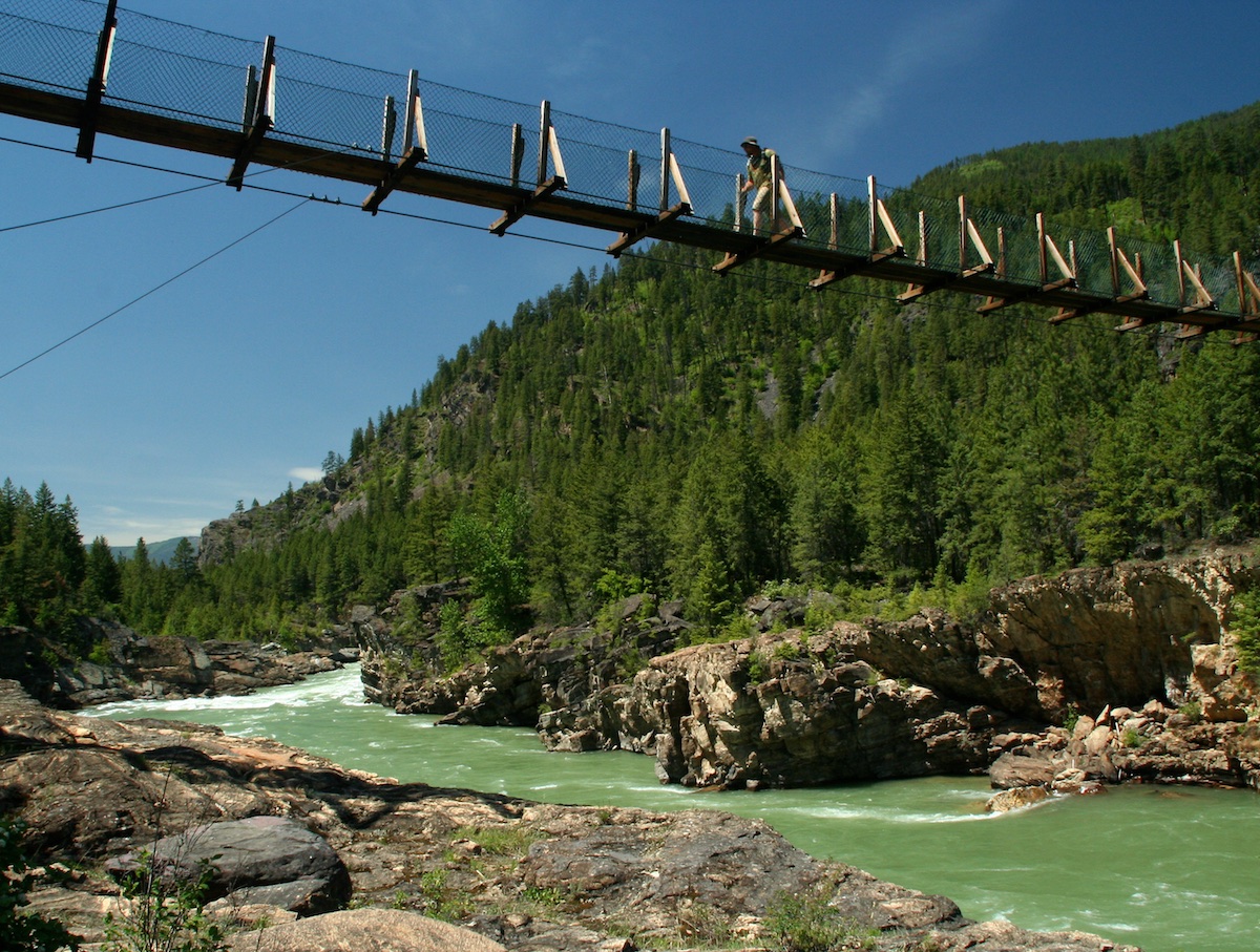
4) Kootenai Falls
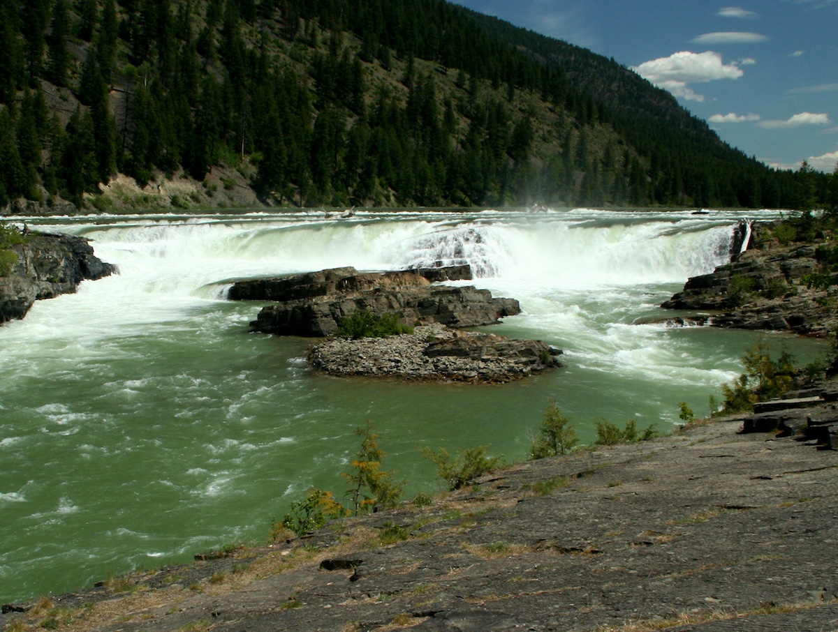
Waterfall, swinging bridge and railroad overpass! This 1.5-mile hike is packed with adventure year-round, especially for kids–just keep young kids away from the edges.
Kootenai Falls is one of the largest free-flowing waterfalls in the Northwest according to the U.S. Forest Service. The main waterfall plunges 30 feet but the whole complex of rapids and waterfalls drops 90 feet in less than a mile.
The first 500 feet of the trail has minimal elevation gain (though the pavement is uneven), enabling handicap access to the first overlook. After that the trail becomes rough and rocky but still family-friendly. The overpass over the railroad tracks has a 3-tier expanded-metal staircase that is not dog-friendly.
The main trail leads left to the swinging bridge (0.5 mile from trailhead). Originally constructed in 1937 by the Civilian Conservation Corps for fire-fighting access, it was destroyed in 1948 by flooding. The bridge was rebuilt in the 1950’s, reconstructed in 1993 and replaced in 2019.
Stromatolites (fossilized algal mounds) abound near both ends of swinging bridge. These rocks are 600 million to 800 million years old.
At the trail junction, a right turn leads to more views of the numerous waterfalls. The river cascades over sedimentary rock layers and it is apparent where the river has eroded the rock away. Along the rivers edge (present and old), there are sedimentary rocks with ripple marks in them revealing a glimpse of the shallow lake or sea that once was here.
Numerous social trails branch off from the main trail to access different beaches, rocks and viewpoints. Please stay on established trails and minimize your impact.
A little history tidbit… In the early 1800‘s, Northwest Company explorer David Thompson portaged around Kootenai Falls on a trail 300 feet above the north side of the river. He was very concerned with taking one wrong step–which is very evident when observing the route from across the river. At the time, the southern bank had a cliff that he was not able to portage around (where the cliff has been blasted and cut back for the highway and railroad).
The Kootenai Falls trailhead is located 39 miles east of Bonners Ferry, 6 miles east of Troy, MT and 12 miles west of Libby, MT on US Hwy 2 at the 21-mile marker. The parking lot is on the north side of the highway and can be quite full during the summer. A picnic area, restrooms and a seasonal concession stand are located next to the parking lot.


Great article, Laura. So glad you are back to writing!
Thanks!