
The Kootenai Valley and the Selkirk, Purcell and Cabinet Mountains are the main geographic features in the county. One geologic feature is responsible for how we see them today–the Purcell Trench.
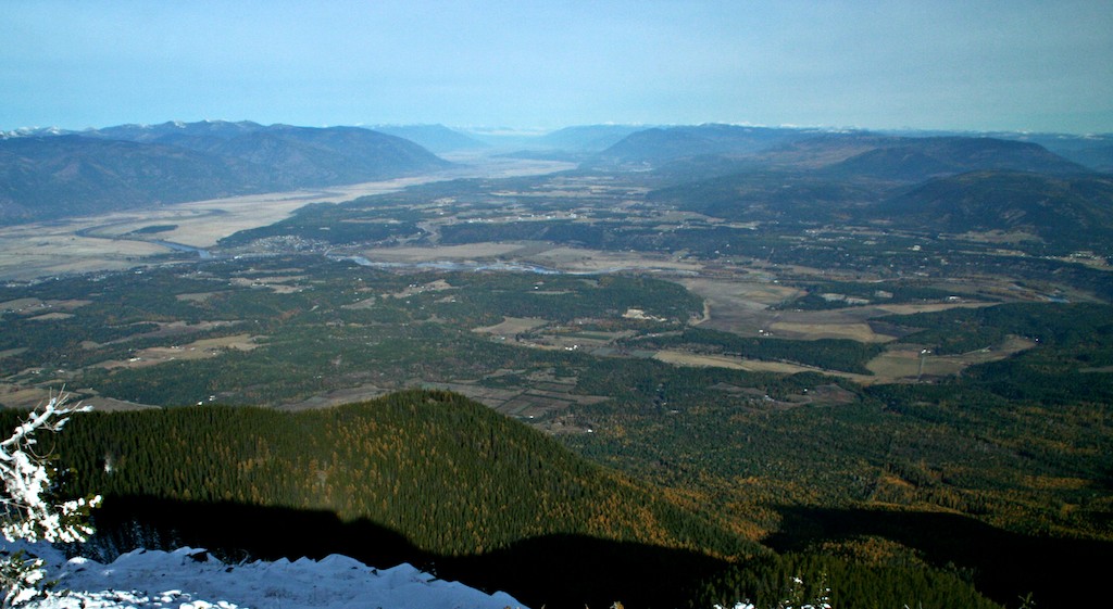
From atop Clifty Mountain (in the Cabinets), the Purcell Trench is visible into Canada
The Purcell Trench is the valley structure between the Selkirk Mountains and the Cabinet and Purcell Mountains. The Purcell Trench extends beyond Boundary County. The southern edge is in Rathdrum Prairie, though it is harder to distinguish south of Sandpoint. The Purcell Trench also extends north into British Columbia where it eventually merges with the Rocky Mountain Trench.
Valleys can be made by erosion (water or glaciers) or by an underlying geologic structure. The Purcell Trench is too long, wide and straight to have been formed by erosion and, therefore, it is a result of a major bedrock structure.
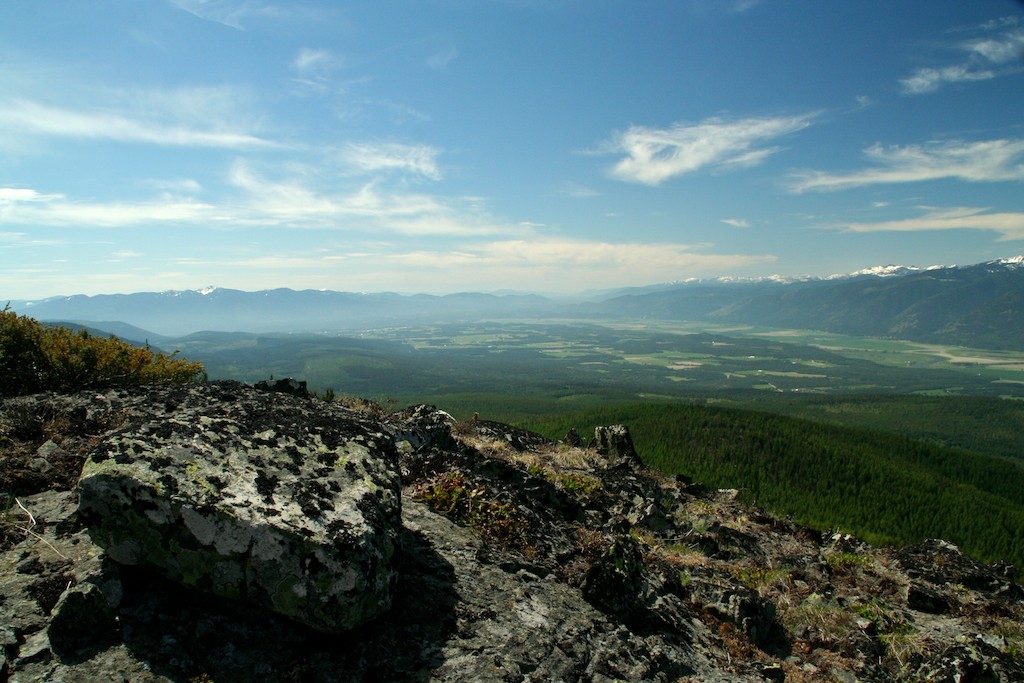
Purcell Trench south as viewed from Tungsten Mountain in the Purcells
One bedrock structure responsible for creating valleys is a fault. The basin and range mountains in Nevada formed because of faulting. A fault is a fracture in rock where sliding occurs (both sides don’t have to move, often it is one piece moving against the other stationary side). The San Andreas fault in California is one example.
There has to be a reason for rock to move and in the case of the Purcell Trench it was because this area was being stretched. As one can imagine, rock isn’t a likely candidate for stretching, so what happens is faulting. Faulting releases the tension built up by stretching.
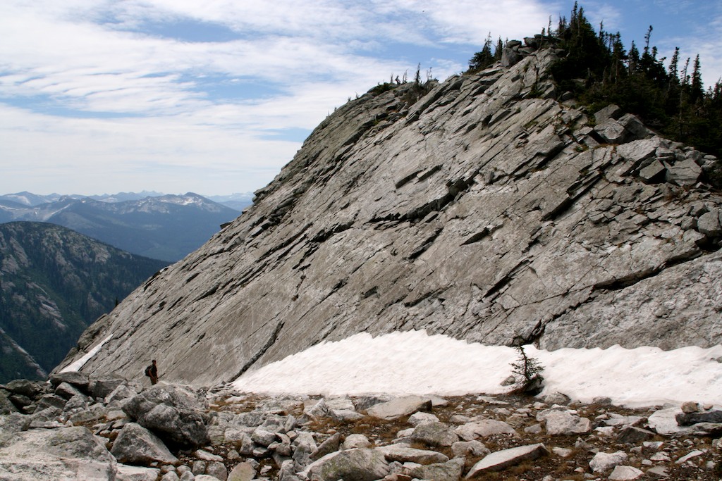
Exposed granite in the Selkirks cooled several miles below the earth’s surface
What caused the stretching? Intruding magma. Long before the ice ages, a large mass of granitic magma was rising in the Earth’s crust under the present day Selkirk Mountains. As the giant bubble of magma neared the surface, it weakened the crust by stretching it.
The giant bubble of granitic magma cooled before it reached the surface, creating a giant granite batholith. But the tension was still there from the stretching. Consider that the granite cooled miles below the surface and now is exposed in the Selkirk Mountains. Something had to move to make the granite visible, it wasn’t eroded away.
Quite a bit of imagination is necessary to envision what happened. The rock that is now the Cabinet and Purcell Mountains was once on top of where the Selkirk Mountains are located. When the magma intruded, it bulged up the overlying rock, much like a bubble forming in pizza crust. To release the tension, a fault formed along the current eastern front of the Selkirk Mountains. Over millions of years the rock on top (the current Purcell and Cabinet Mountains) slowly slid down the fault in an easterly direction into their current position, leaving an open trench behind. That open trench is now called the Purcell Trench.
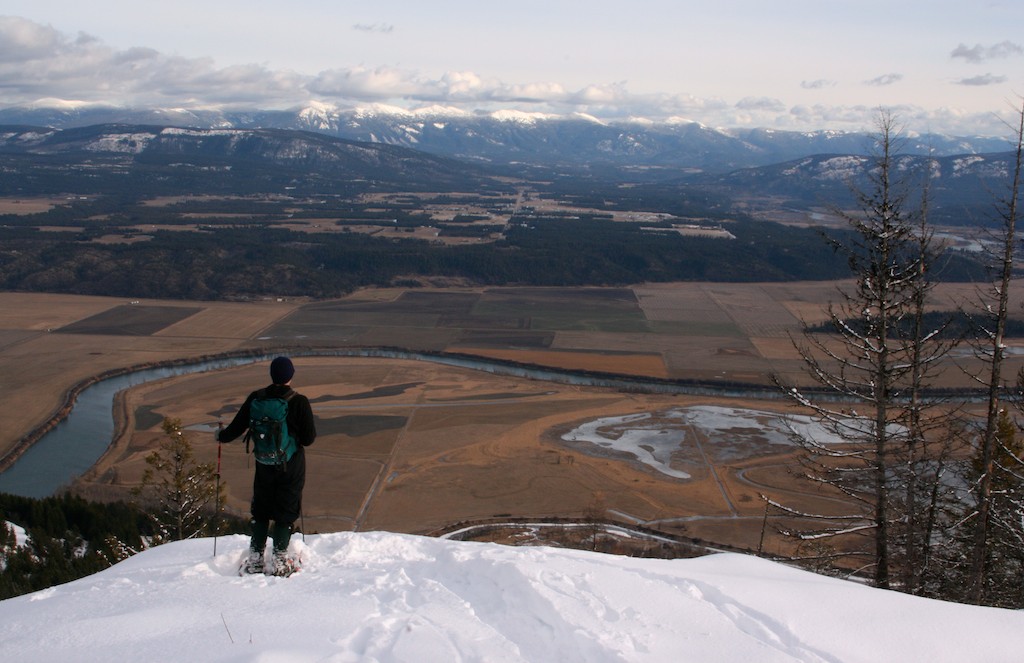
Looking east across the Purcell Trench at the Purcell Mountains
As the overlying rock slid eastwards, the granite batholith was exposed.
The rocks around the fault zone are under tremendous pressure as the faulting occurs, which results in folding and metamorphosing the rocks. Rocks along the eastern front of the Selkirk Mountains may have a shiny look to them, with all the crystals aligned in one direction–these rocks were altered by the heat and pressure in the fault zone.
Have you taken a close look at the rock cut where the Myrtle Creek Road takes off from the West Side Road? This rock was folded deep in the crust along the fault zone as the Purcell Trench was being formed.
The Purcell Trench doesn’t look the same today as it did after it was initially created. Glaciers, lakes and rivers have scoured, eroded and deposited sediment to create the valley we know today as the Kootenai Valley.


Great article!!! It clearly explains how this “trench” evolved.
One misspelling might be fixed as follows: “As the overlying rock slide off to the east, the granite batholith was exposed.” This should read, “As the overlying rock slid eastwards, the granite batholith was exposed.”
Thank you.
Very helpful article. Have driven by the historical geologic site sign but until now, we never realized how special this area is. Thank you for posting it!
You’re welcome!
Thanks Laura,
The geology in this region is fascinating. You have done a masterful job sharing what you have learned. I have heard that the Purcell Trench is also one of a few nuclear fallout safe havens. Is there any truth to that?
Hi Roger,
Thank you.
I’ve never heard about the Purcell Trench being a nuclear fallout safe haven but it would be interesting to find out.
Laura
Why does the brass plate on the back of the Purcell trench historical marker have the location of the BC border and signal hill location?
Good question! I’ll have to take a look at that.
GPS coordinates for Waymarking. Waymarking uses GPS coordinates to mark, visit, and share locations around the world. Waymarking highlights interesting places like historical buildings, statues, or natural locations. Similar to Geocaching.
How can I obtain permission to use the leading photograph in this article? It’s wonderful! Please contact me via email so that we might discuss this.
Thank you.
Miturn
Thank you for this information! I loved my geology class and how rocks are history books of a place. This brought back those memories. Very well done.