
Tis the season of spring migration and as birds return to their northern summering grounds, I return to my summering grounds in Bettles, Alaska. Located almost 30 miles north of the Arctic Circle, Bettles is a small town on the banks of the Koyukuk River south of the central Brooks Range. Located next to the native village of Evansville, both operate as one town sharing a post office, grocery store, airport and power plant.
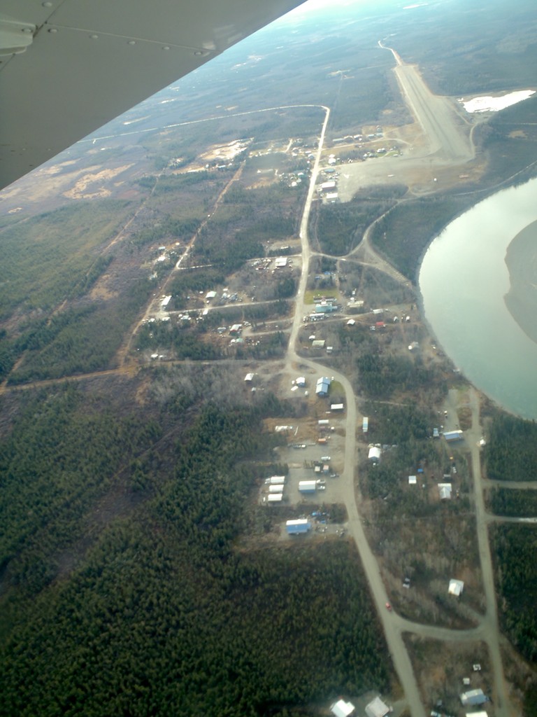
Aerial view of Bettles and Evansville (Note mile-long runway in upper right corner for scale).
As seasonal workers arrive during April and May the population doubles from a mere 25 people to about 50 people. Summer employees work for two air services, a lodge, the National Park Service and the US Fish and Wildlife Service. With the typical small town atmosphere, everybody knows everybody.
A major event for Bettles is the opening of the winter road which connects Bettles to the road system for one to two months every year. During late winter, the snow is plowed from a right-of-way cleared through the spruce forest to create a one-lane road that connects Bettles to the Dalton Highway (also known as the Haul Road) about 40 miles south of Coldfoot.
This connection to the road system is a welcome relief from flying into Fairbanks, which is the only means of going anywhere the rest of the year. Almost everyone makes the five- to six-hour drive into Fairbanks to stock up on groceries, fuel and supplies for the coming year. Shopping for an entire year’s worth of groceries is a shock to the checkbook but it beats paying freight on the airlines which costs around 80 cents a pound. Once spring break-up arrives, the winter road turns to slush and the town is dependent on air transportation once again.
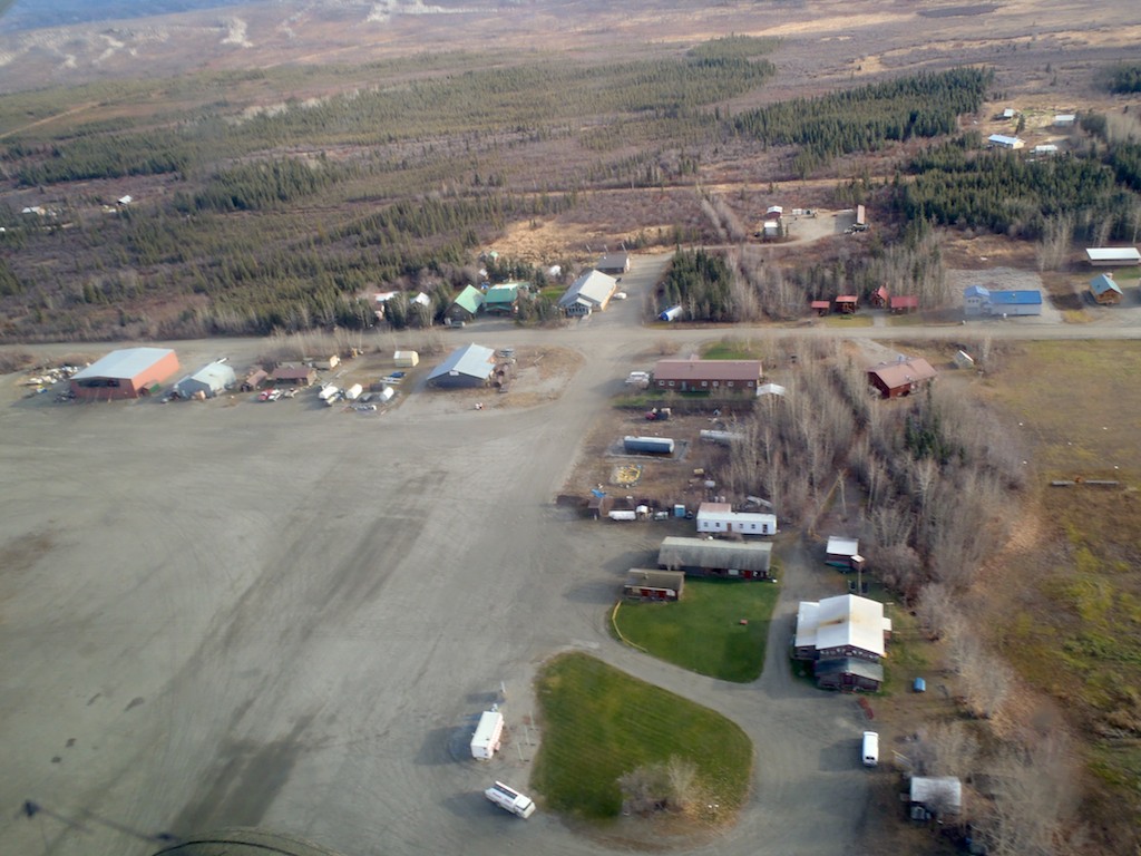
Aerial view of Bettles Airport–the main hub of activity in the summer.
The main reason for Bettles existence today is as a jumping-off point for hikers, rafters and hunters to the Brooks Range, mainly Gates of the Arctic National Park and the Arctic National Wildlife Refuge. However, Bettles’ history hasn’t always been centered on tourism. Bettles began as an airstrip to support airplanes flying to the North Slope and as a stop on the Hickel Highway (an ice road) that brought supplies to the North Slope before the Dalton Highway was built. Now the Hickel Highway is a narrow clearing that acts as a winter trail for snowmachiners and dog mushers to access southern portions of the Brooks Range.
Bettles was a booming town during the hey-day of the oil boom on the North Slope with over a hundred people residing here. There was a school and year-round grocery store. Now the school sits empty since there is only one kid in town and a minimum of ten kids is needed for the school to operate. The grocery store is only open in the summer and occupies half of an ATCO trailer, carrying mainly fresh produce, perishable foods and frozen treats.
Scheduled airplanes come in daily to deliver mail, freight and passengers, with the largest plane carrying nine passengers. As summer comes into full swing, the town becomes a buzz of activity as airplanes constantly come and go under the midnight sun. But as winter descends in late September, the seasonal workers head south to warmer grounds while the hardy residents endure the cold, long, dark winter above the Arctic Circle.


