
“Where am I?” “How high am I?” These questions are easy to answer today with a GPS. People have always wondered where in the world they were located. Where is Bonners Ferry in relation to New York City?
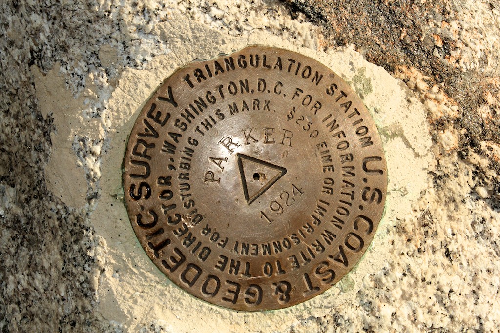
The benchmark on Parker Peak was placed in 1924 with no trails to the peak
The National Geodetic Survey (NGS) was established in 1807 to provide the framework for all positioning activities in the nation, including latitude, longitude and elevation. Without knowing the latitude and longitude of a location, no relationship could be established between faraway places except for a general direction.
Beginning in 1833, the NGS placed the first survey disc north of New York City. Today, these discs are found on mountaintops, bridges, post offices (including Bonners Ferry) and prominent landmarks across the nation. Numerous peaks around the county bear a small metal disc with an identifier and other information.
Benchmark is the generic term for all geodetic control points. There are two main types of benchmarks: vertical control points and horizontal control points.
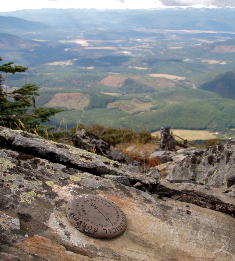
This benchmark references the Goat Mountain Lookout which no longer exists.
Vertical control points, as the name suggests, marks a precise elevation above sea level. Vertical control points are true bench marks with the word “BENCH MARK” printed on the rim of the disc.
Horizontal control points mark a precise latitude and longitude. Professionals refer to horizontal control points as stations or marks.
Besides metal discs, benchmarks can be a bolt, rivet, chiseled square or cross, or prominent landmark, such as a church spire or water tower. Each benchmark is linked to an identifier and a datasheet describing the location.
Not all metal discs represent a precise elevation, longitude or latitude. Some discs contain arrows, RM or AZ and these discs help surveyors locate the bench marks, stations or land boundaries.
Benchmarks were primarily placed by two sources: the NGS and the U.S. Geological Survey (USGS). Between 1878 and 1970, the NGS was called the U.S. Coast and Geodetic Survey.
Over 730,000 benchmarks exist in the United States (including Alaska and Hawaii) with precise elevations or coordinates. However, many more exist because of the USGS. The USGS placed thousands of benchmarks to assist them in creating topographic maps. However, they are not in the NGS database because they were not “bluebooked”, meaning they did not undergo a process that ensures the disc meet minimum geodetic quality requirements.
Those with GPS units may find disparities between the elevation on the GPS and that which is printed on the map. This difference may lead to the question, “How high is the summit?”
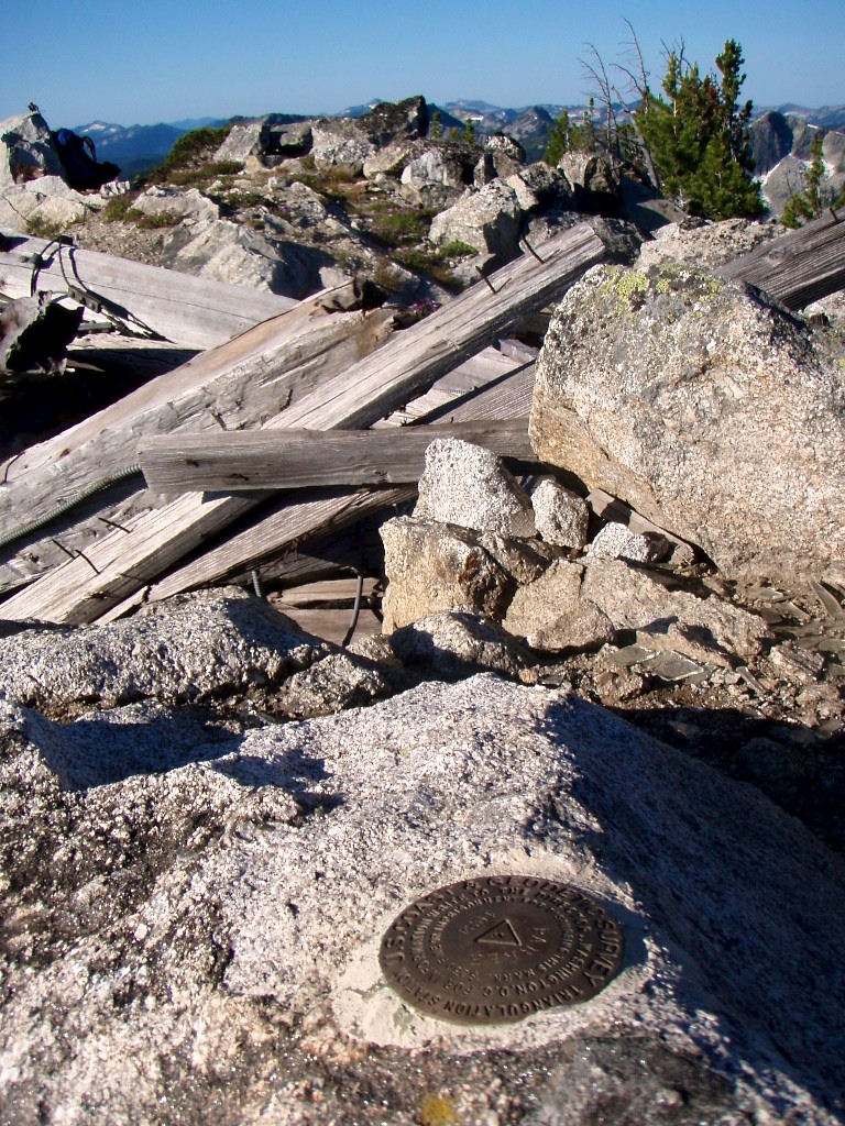
Many benchmarks offer the finder a commanding view of the surrounding country
NGS suggests that traditional leveling techniques are more accurate than GPS databases. However, differences in elevation occur over time due to inaccuracies, new surveys and tectonic movements.
Surveying across an entire mountain range and beginning with an inch discrepancy can lead to slight inaccuracies in the end.
One of the reasons for the difference between the true elevation and the elevation stated on a map is the original reference point. Originally, all elevations were based on NGVD 29, a reference based on mean sea level (an average from several locations). Later, elevations were based on NAVD 88, one sea level measurement at the St. Lawrence Seaway. Many maps have not been updated to reflect the switch to NAVD 88, which resulted in a several foot difference in some locations.
Lastly, the Earth is in constant flux with mountain ranges lifting up or eroding down as tectonic plates move. Mt. Borah, Idaho’s highest peak, gained seven feet of elevation in 1983 when a 7.3 magnitude earthquake shook the land.
The question of “how high am I?” can change in an instant but for the most part the early surveyors used techniques that provided accurate positions. Surveyors ranged across the countryside without the help of today’s trails or helicopters to satisfy their curiosity of “Where am I?”


