
One of the first things I do every morning is look outside and see what type of day it’s going to be. I always hope for bluebird days filled with sunshine, but if clouds are present I take a guess at what the day might be like. Will it be overcast or rainy? Does the thin layer of high clouds indicate an incoming storm?
Clouds show us what is happening in the atmosphere–mainly that warm, moist air is rising, expanding and cooling. Since cool air cannot hold as much water vapor as warm air, some of the vapor condenses onto dust particles in the cooler atmosphere. When billions of these droplets come together in the same area, a cloud is visible.
When looking at clouds notice the cloud’s height and appearance. Clouds are broken into three levels:
- High– above 20,000 feet
- Medium– 6,500 to 20,000 feet
- Low– below 6,500 feet
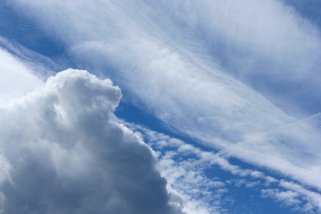
Both high- and mid-level clouds reflect height in their name: high-level cloud names contain “cirro-” and mid-level cloud names contain “alto-”. For example, cirrus clouds are a common high-level cloud that are wispy and feathery in appearance. They indicate fair weather but forewarn that a change will occur within 24 hours.
Low-level cloud names are based on their appearance instead of height. Either the cloud develops horizontally in a layer (stratus) or it develops vertically (cumulus). Stratus and cumulus clouds are present at all heights and the prefix helps describe where they are if not at a low-level. For example, altostratus clouds are flat, uniform clouds found at mid-levels. They often form ahead of a storm that will produce continuous rain or snow.

Stratus clouds are the clouds that can sock in the Kootenai Valley for days in the winter and produce no precipitation. If the cloud deck thickens and produces steady precipitation, then the clouds are called nimbostratus (“nimbo” meaning precipitation). Both altostratus and stratus clouds can morph into nimbostratus clouds.
On the brighter side, cumulus clouds are fair weather clouds. They fill summer skies with puffy, cotton-ball shapes that we lay back and watch. While the weather may be nice, the air is turbulent and anyone flying in an airplane will have a bumpy ride. Cumulus clouds show that there are pockets of warm air rising into the atmosphere.
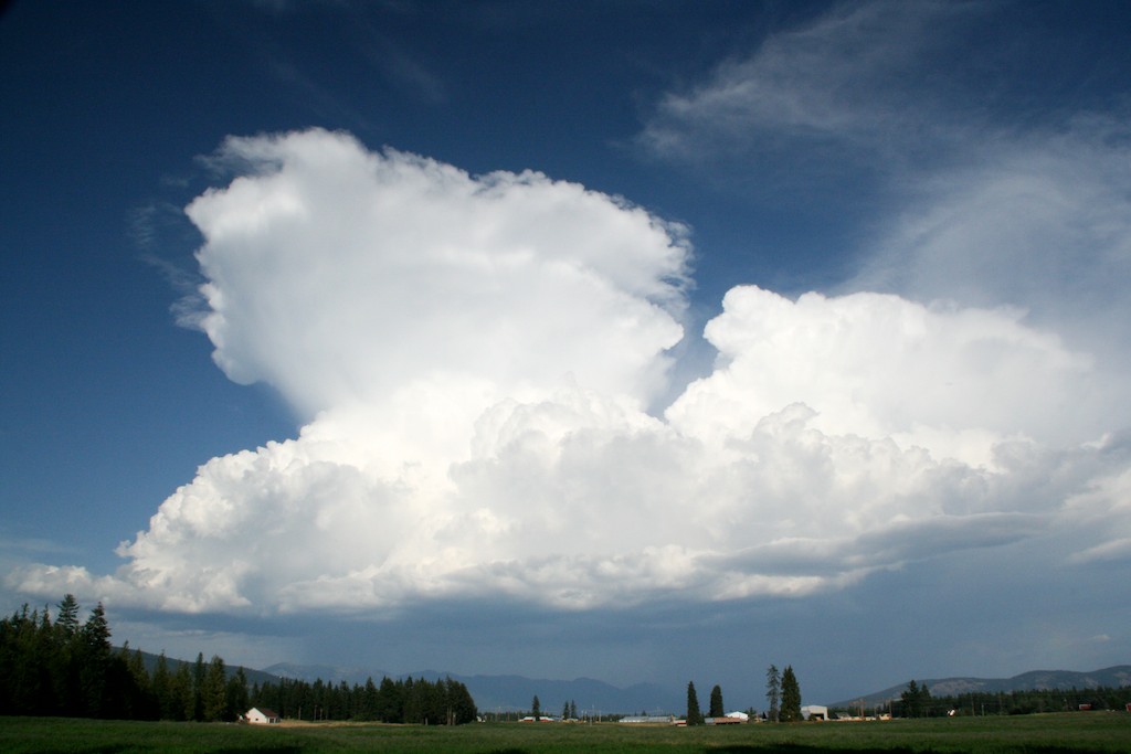
When there is extreme instability in the atmosphere (like on a hot August afternoon), cumulus clouds can become towering cumulus clouds that mature into cumulonimbus clouds. Cumulonimbus clouds, also called thunderheads, have the anvil-shaped top and can produce lightning, thunder, hail, heavy rain and tornadoes. But there needs to be significant heat rising from the ground to produce cumulonimbus clouds, which is why we typically only see them during warmer months. On a summer morning, if the sky is filled with altocumulus clouds (often aligned in rows) watch for thunderstorm activity in the afternoon.
Not all clouds fit into the cookie-cutter names but by identifying clouds by their appearance and height, you can at least guess what the day may be like.
Originally posted May 2012. Updated February 2024.


